
Utilizing AI and Satellite Imagery to Map Hidden Ocean Activities, Including Fishing, Shipping, and Energy Development
Humans are rushing to tap into the immense potential of the ocean to drive global economic expansion. Globally, ocean-based industries such as fishing, shipping, and energy production contribute to at least US$1.5 trillion in economic activity annually and support 31 million jobs. This economic value has been growing exponentially over the past five decades and is projected to double by 2030.[1]
Maintaining transparency in monitoring this "blue acceleration" is vital to prevent environmental deterioration, overexploitation of fisheries and marine resources, and illicit activities like illegal fishing and human trafficking. Access to open information will also enable countries to better manage critical ocean resources. However, the vast expanse of the ocean has made tracking industrial activities on a large scale impractical—until now.
A newly published study in the journal Nature combines satellite images, vessel GPS data, and artificial intelligence to unveil human industrial activities across the ocean over a five-year period. Led by researchers at Global Fishing Watch, a nonprofit organization dedicated to enhancing ocean governance through increased transparency of human activity at sea, this study was conducted in collaboration with experts from Duke University, the University of California, Santa Barbara, and SkyTruth.
The study reveals a significant amount of activity occurring outside of public monitoring systems. Our newly created map and dataset offer the most comprehensive public overview available of industrial utilization of the ocean.
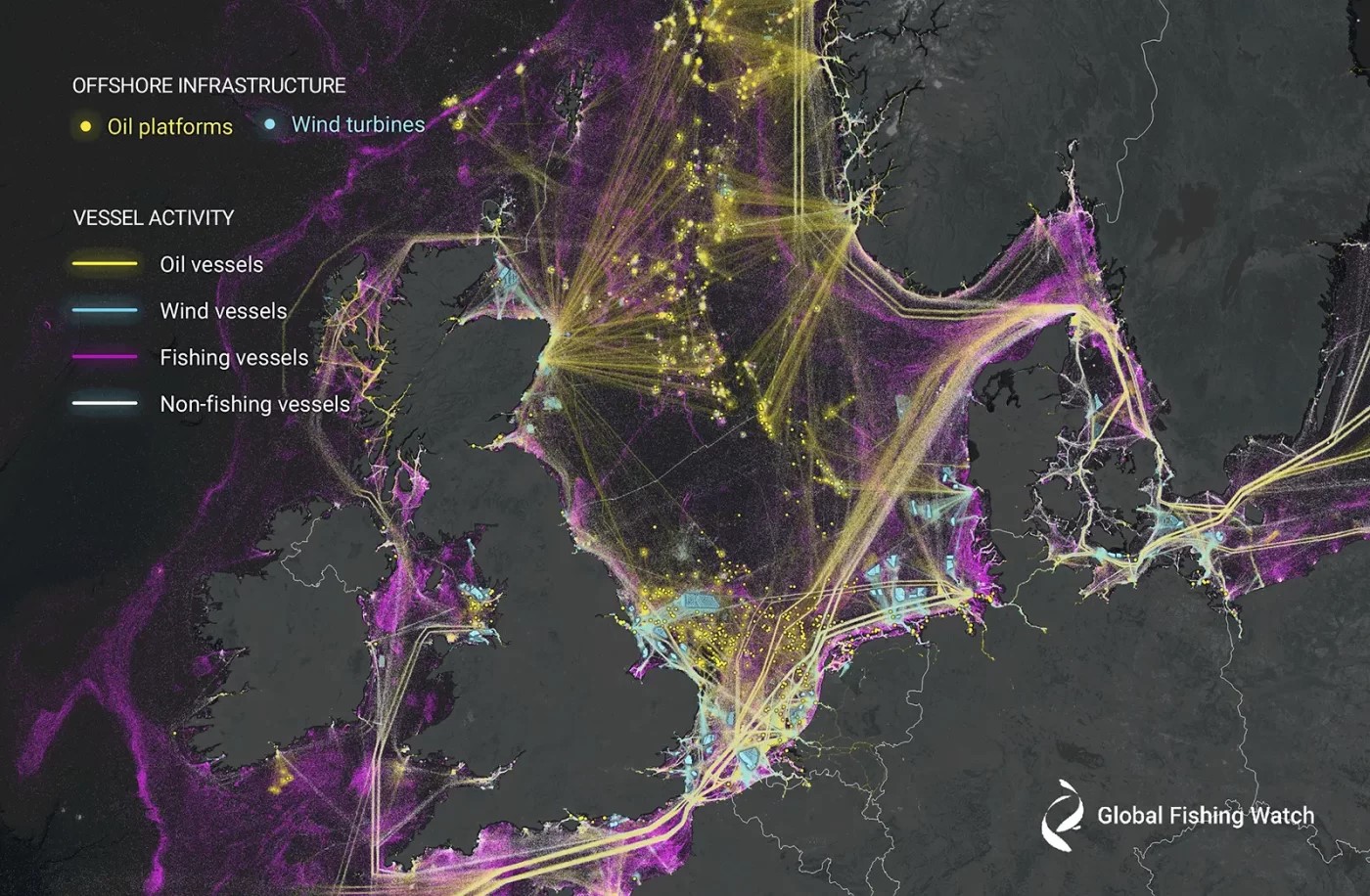
Figure 1. Global Fishing Watch uses AI and satellite imagery to map vessel traffic and offshore infrastructure to provide an unprecedented view of previously unmapped industrial use of the ocean, as seen here in the North Sea.
Navigating in the Darkness
Figure 1 shows Global Fishing Watch uses AI and satellite imagery to map vessel traffic and offshore infrastructure to provide an unprecedented view of previously unmapped industrial use of the ocean, as seen here in the North Sea. Our research extends the capabilities of current technology to offer a more comprehensive understanding than previously attainable.
For instance, numerous vessels are equipped with an automatic identification system (AIS), which autonomously transmits essential vessel details including identity, position, course, and speed. These devices facilitate improved situational awareness and mitigate the risk of sea collisions by communicating with nearby AIS devices. Moreover, they transmit data to shore-based transponders and satellites, enabling the monitoring of vessel traffic and fishing activities.
Illuminating Maritime Activity
We addressed these gaps by employing artificial intelligence models to distinguish fishing vessels, non-fishing vessels, and fixed infrastructure in 2 million gigabytes of satellite-based radar images and optical images captured across the ocean between 2017 and 2021. Additionally, we correlated these findings with 53 billion AIS vessel position reports to determine the vessels that were publicly trackable at the time of imaging.
Remarkably, our analysis revealed that approximately 75% of the fishing vessels we identified were absent from public AIS monitoring systems, with a significant portion of this activity concentrated around Africa and South Asia. These previously undetected vessels substantially altered our understanding of the scale, extent, and geographical distribution of fishing activity.
For instance, while public AIS data incorrectly suggests comparable fishing levels between Asia and Europe, our mapping demonstrated that Asia predominates. Similarly, while AIS data indicates a tenfold difference in fishing activity between the European and African sides of the Mediterranean, our findings indicate roughly equal activity across both areas.
Regarding other vessels, primarily related to transportation and energy, approximately 25% were absent from public AIS monitoring systems. Many of these missing vessels were located in areas with poor AIS reception, suggesting they may have transmitted their locations but were not detected by satellites.[2]
Furthermore, we identified approximately 28,000 offshore structures, predominantly comprising oil platforms and wind turbines, as well as piers, bridges, power lines, aquaculture farms, and other man-made structures. Over the five-year period, offshore oil infrastructure experienced modest growth, while the number of wind turbines more than doubled globally, with most development occurring in northern Europe and China. It is estimated that by the end of 2020, the number of wind turbines in the ocean likely exceeded the number of oil structures.[3]
Reference:
- https://www.pixstory.com/story/we-used-ai-and-satellite-imagery-to-map-ocean-activities-that-take-place-out-of-sight-including-fis/289148
- https://theconversation.com/we-used-ai-and-satellite-imagery-to-map-ocean-activities-that-take-place-out-of-sight-including-fishing-shipping-and-energy-development-219367
- https://globalfishingwatch.org/press-release/new-research-harnesses-ai-and-satellite-imagery-to-reveal-the-expanding-footprint-of-human-activity-at-sea
Cite this article:
Gokila G (2024), Utilizing AI and Satellite Imagery to Map Hidden Ocean Activities, Including Fishing, Shipping, and Energy Development, AnaTechMaz, pp. 395
Recent Post
-
Intel Has Unveiled the Largest Neuromorphic Computer Inspired by The Brain
Intel has developed the world's largest neuromorphic computer, aiming to replicate...
-
AI Using Satellite Images Has Detected Ships Engaged in Smuggling Russian Oil
Artificial intelligence has the capability to analyze satellite imagery, uncovering the...
-

Life-Saving Hospital Trial Utilizes AI Predicting Mortality Risk
In a groundbreaking clinical trial involving nearly 16,000 patients across two...
-

GPT-4: 82% More Persuasive Than Humans, And AI Now Reads Emotions
New research indicates that GPT-4 surpasses the average human in...
-
Utilizing AI and Satellite Imagery to Map Hidden Ocean Activities, Including Fishing, Shipping, and Energy Development
Humans are rushing to tap into the immense potential of the ocean to drive...
-
Advancements In Robotics: AI-Powered Robots Now Autonomously Repairing Other Bots
In January, researchers showcased the culinary abilities of an open-source...
-

Advancing Humanoids: Ubtech's Walker S Equipped with Conversational AI
Continuing the momentum set by the GPT-enhanced Figure 01 humanoid that...
-

AI Risk Assessment System Proves Life-Saving in Hospital Trial
"An AI system has shown its life-saving potential by notifying doctors of patients...
-
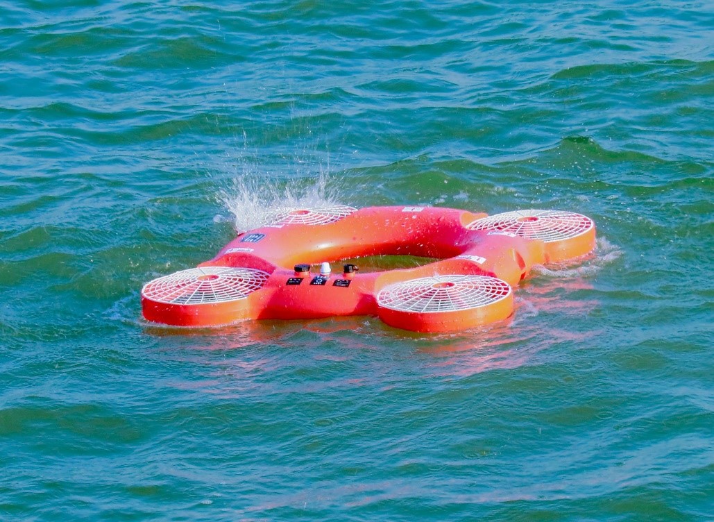
Hybrid Rescue Drone Transforms into Lifebuoy to Aid Swimmers
You might not be able to physically toss a lifebuoy to a swimmer one kilometer....
-

Here's Why Artificial Intelligence Such as ChatGPT Likely Won't Achieve Human-Like Understanding
If you were to inquire of ChatGPT whether it possesses human-like thought...
-

AI Bot Showdown: Copilot Vs ChatGPT Vs Gemini
In the age of artificial intelligence (AI), chatbots have become essential ...
-
AI Model Predicts Need for Mental Health Services in Cancer Care
Researchers from UBC and BC Cancer have developed an innovative artificial...
-

AI Method Improves Identification of Toxic Chemicals and Reduces Reliance on Animal Testing
Researchers at Chalmers University of Technology and the University of ...
-

Introducing ChemCrow, the Revolutionary AI in Chemistry
In the realm of chemistry, automation has long been a formidable challenge...
-
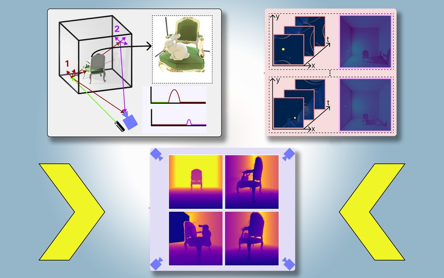
PlatoNeRF: Enhancing Autonomous Vehicles and AR/VR with Advanced 3D Scene Reconstruction Technology
Imagine driving through a tunnel in an autonomous vehicle, unaware that a crash...