
Overview of Synthetic Aperture Radar
A Synthetic Aperture Radar (SAR), or SAR, is a coherent mostly airborne or spaceborne sidelooking radar system which utilizes the flight path of the platform to simulate an extremely large antenna or aperture electronically, and that generates high-resolution remote sensing imagery. Over time, individual transmit/receive cycles (PRT's) are completed with the data from each cycle being stored electronically. The signal processing uses magnitude and phase of the received signals over successive pulses from elements of a synthetic aperture. After a given number of cycles, the stored data is recombined (taking into account the Doppler effects inherent in the different transmitter to target geometry in each succeeding cycle) to create a high-resolution image of the terrain being over flown. [1]
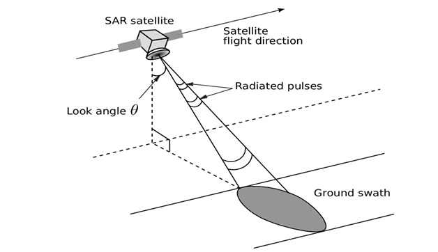
Figure 1. Overview of Synthetic Aperture Radar
Figure 1 shows SAR technology provides terrain structural information to geologists for mineral exploration, oil spill boundaries on water to environmentalists, sea state and ice hazard maps to navigators, and reconnaissance and targeting information to military and intelligence operations. There are many other applications for this technology. Some of these, particularly civilian, have not yet been adequately explored because lower cost electronics are just beginning to make SAR technology economical for smaller scale uses. [2]
The Role of Frequency and Wavelength
Optical sensors such as Landsat's Operational Land Imager (OLI) and Sentinel-2's Multispectral Instrument (MSI) collect data in the visible, near-infrared, and short-wave infrared portions of the electromagnetic spectrum. Radar sensors utilize longer wavelengths at the centimeter to meter scale, which gives it special properties, such as the ability to see through clouds (view electromagnetic spectrum to the right). The different wavelengths of SAR are often referred to as bands, with letter designations such as X, C, L, and P. The table below notes the band with associated frequency, wavelength, and the application typical for that band. [3]
24/7 reliable monitoring
EO sensors typically depend on solar illumination, which means the information they can provide at night is very limited. The wavelengths captured by most EO systems also are not able to penetrate well through cloud or hazy atmosphere. Typically, EO sensors are launched into sun-synchronous orbits where they pass over targets at the same time in the morning to avoid cloud formation.
Because SAR systems are self-illuminating and the wavelength used can penetrate clouds, fog, smog, darkness and smoke, they can be effectively used in a variety of polar or inclined orbits to increase the diversity of observation times. This orbit diversity and ability to see through any atmospheric conditions allows SAR to collect images at any time of day or night. It also ensures that users of SAR can reliably and consistently monitor their areas of interest. [4]
References:
- https://www.radartutorial.eu/20.airborne/ab07.en.html
- https://www.sandia.gov/radar/pathfinder-radar-isr-and-synthetic-aperture-radar-sar-systems/what-is-sar/
- https://earthdata.nasa.gov/learn/backgrounders/what-is-sar
- https://www.capellaspace.com/the-key-benefits-a-sar-constellation-can-bring-to-earth-observation/
Cite this article:
Thanusri swetha J (2021) Overview of Synthetic Aperture Radar, AnaTechMaz, pp. 44
Recent Post
-

A Sources of Haptic Technology
Haptic technology, or haptics, is a tactile feedback technology which takes advantage of the sense of touch by applying forces...
-
Advantages of 3D Printing House
Houses that are designed and built using construction technologies that use the 3D printing method are known as 3D printed homes...
-
Benefits of Exascale Computing
Exascale computing refers to computing systems capable of at least one exaflop or a billion billion calculations per second (1018)...
-

Benefits of Scanbo
Diabetics have to deal with countless needle sticks or use implants to record their blood sugar. But in the future...
-
Body Scan – Withings
Withings isn’t a stranger to smart scales, but for CES 2022 the company is taking a much more ambitious take on the gadget...
-

Brain-Computer interface (BCI)
A brain-computer interface, sometimes called a neural-control interface, mind-machine interface, direct neural interface...
-
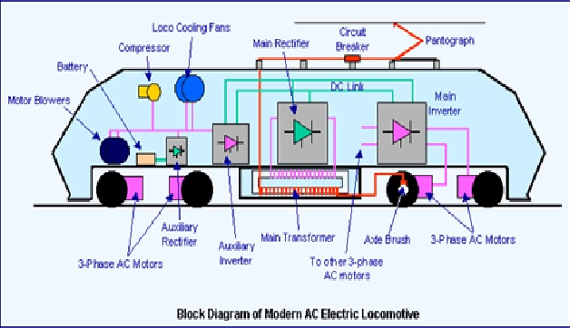
Electric Locomotives (Electric Trains) Work
An “Electric Locomotive” is a railway vehicle that can move along rails and push or pull a train attached...
-

Elements and principles of Visual Design Standards
Visual design aims to improve a design’s/product’s aesthetic appeal and usability with suitable...
-
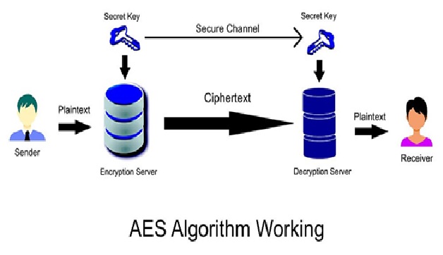
Image Encryption using AES Algorithm
To increase needed for exchanging digital photos electronically, due to alarming demand for multimedia...
-
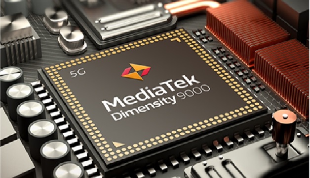
MediaTek Officially Launches Dimensity 9000 Flagship Chip
Fabless chip maker MediaTek today formally launched its much-talked-of...
-
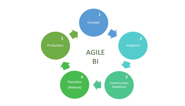
Methodology of Agile BI
Agile BI is a recurring process that requires continuous development of online data visualization, dashboards, reports...
-
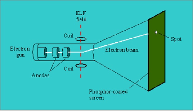
Overview of Cathode Ray Tube (CRT)
A cathode-ray tube (CRT) is a specialized vacuum tube in which images are produced...
-

Overview of iTwin Technology
iTwin Services are a set of cloud services for creating, visualizing, and analyzing digital twins of infrastructure assets...
-
Overview of Synthetic Aperture Radar
A Synthetic Aperture Radar (SAR), or SAR, is a coherent mostly airborne or spaceborne sidelooking radar system...
-

Process of Iris Scanning in Biometrics
Iris recognition or iris scanning is the process of using visible and near-infrared light to take...