
The Geographic Information System (GIS) is Enabling the Agricultural Sector
GIS stands for Geographic Information System. GIS is any digital data that contains location-based information. This location information in the GIS industry is termed as ‘spatial data’. It can be an address or the coordinates of a place (latitude and longitude). [1] It can also be a complex three-dimensional geometry. The use of GIS is shown in Figure 1.
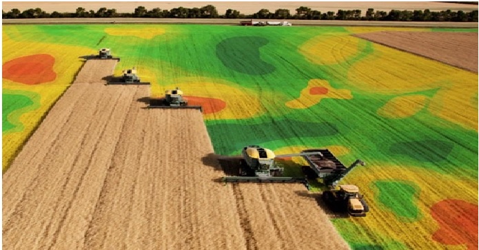
Figure 1. The use of GIS in Agriculture
Geographic Information System GIS technology has become a multimillion-dollar industry that employs thousands of people worldwide and is estimated to be growing at an annual rate of 25% [2]. Many private and government organizations, whose activities are largely dependent on geographic information, are rapidly adopting GIS software and technology.
Geographic Information System integrates many types of geographic data. It analyses the spatial location of a place and organizes layers of information into visualizations making use of 3D scenes and GIS maps. With this feature, it provides deeper insights into data such as patterns, relationships and situations – helping experts make smarter decisions.
GIS in agriculture is not a new phenomenon anymore. The agricultural sector is the mainstay of the rural Indian economy around which socio-economic privileges and deprivations revolve, and any change in its structure is likely to have a corresponding impact on the existing pattern of social equality. [3] No strategy of economic reform can succeed without sustained and broad-based agricultural development, which is critical for raising living standards, alleviating poverty, assuring food security, generating a buoyant market for expansion of industry and services and making a substantial contribution to the national economic growth.
The future growth in agriculture must come from new technologies which are not only cost-effective but also in conformity with natural climatic regime of the country; technologies relevant to rain-fed areas specifically; continued genetic improvements for better seeds and yields; data improvements for better research, better results, and sustainable planning; bridging the gap between knowledge and practice; and judicious land use resource surveys, efficient management practices and sustainable use of natural resources.
Sustainable agricultural production depends on the judicious use of natural resources (soil, water, livestock, plant genetic, fisheries, forest, climate, rainfall, and topography) in an acceptable technology management under the prevailing socio-economic infrastructure. Technology plays an important role in the rapid economic growth and social transformation in developing countries.
The use of GIS in agriculture is all about analysing the land, visualizing field data on a map, and putting those data to work. [4] Powered by GIS, precision farming enables informed decisions and actions through which farmers get the most out of each acre without damaging the environment.
Speaking of tools, geospatial technology in agriculture relies on satellites, aircraft, drones, and sensors. These tools are used to make images and connect them with maps and non-visualized data. As a result, you get a map featuring crop position and health status, topography, soil type, fertilization, and similar information.
References:
- https://www.aaaksc.com/gis-in-agriculture/
- https://smallfarms.cornell.edu/2017/04/use-of-gis/
- https://www.geospatialworld.net/blogs/gis-in-agriculture/
- https://intellias.com/gis-in-agriculture/
Cite this article:
Vinotha D (2022), The Geographic Information System (GIS) is Enabling the Agricultural Sector, AnaTechMaz, pp.211
Recent Post
-
The Geographic Information System (GIS) is Enabling the Agricultural Sector
GIS stands for Geographic Information System. GIS is any digital...
-
The Technology Method of Regenerative Medicine
An orthopaedic implant is a device surgically placed into the body designed...
-
The Technology of Surgical Device: Orthopaedic Implants
An orthopaedic implant is a device surgically placed into the body...
-

The Various Types of Orthopaedic Implants
Now let’s look at the various types of orthopaedic implants and their...
-
NASA’s New Satellite to Analyze Climate Change
NASA’s new shoebox-sized satellite tv for pc referred to as the Compact...
-
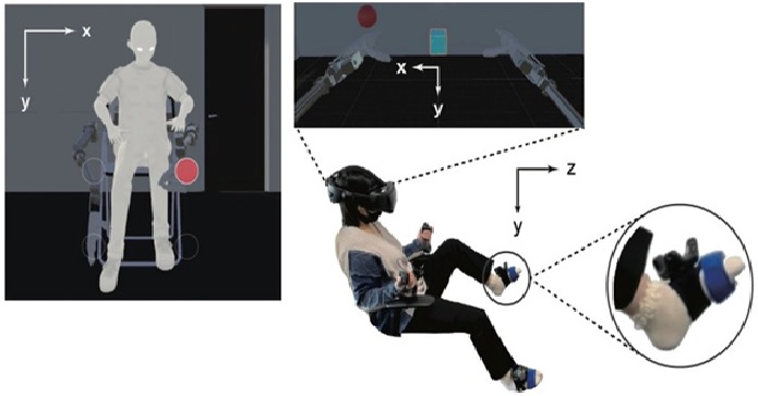
VR Device Gives the Sensation of Having Extra Pair of Robot Arms
Doctoral student Ken Arai and Prof Masahiko Inami from the University...
-

3 Key Considerations for the Next Generation of HMI
In the past, a human machine interface (HMI) consisted of a physical...
-

New method causes plastics to break down under UV light
Researchers in the UK have developed a novel method to break down...
-
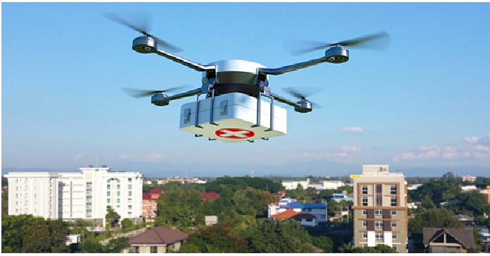
NHS Trials Medicine Delivery Via Drones
NHS cancer patients will be the first in the world to benefit from...
-
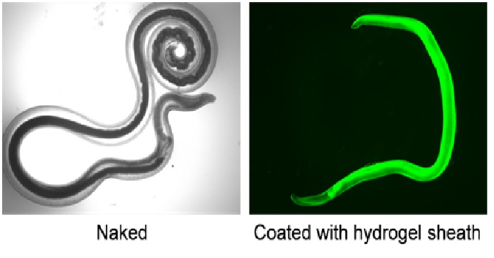
Scientists have created Worms that can Kill Cancer Cells
Researchers at Osaka University found that the worms may be...
-
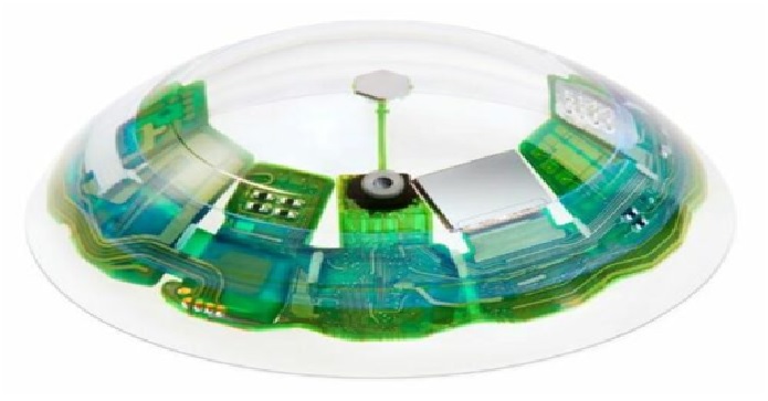
Smart Contact Lens are the Future of AR
The next revolution in Augmented Reality (AR) seems to be...
-

New Algorithm that Allows Human to Assist Robot
Rice University engineers have created a technique that...
-
New Technique for Imaging mRNA in the Living Mice Brain
A team of researchers led by a University of Minnesota Twin Cities...
-

Stars can Travel Around the Black Hole in Four Years
Researchers at the University of Cologne and Masaryk University in Brno...
-
Benefits of vEPC (virtual Evolved Packet Core)
Virtual Evolved Packet Core (vEPC) is a framework for virtualizing...