NISAR: The Advanced Satellite Set to Monitor Earth's Hidden Movements
NASA and ISRO's NISAR satellite is set to transform our understanding of Earth's surface movements through regular global scans.
By detecting subtle movements in land and ice, the satellite will improve predictions for earthquakes and volcanic eruptions, as well as monitor infrastructure stability in ways that were previously impossible, saving valuable time and resources in disaster management.
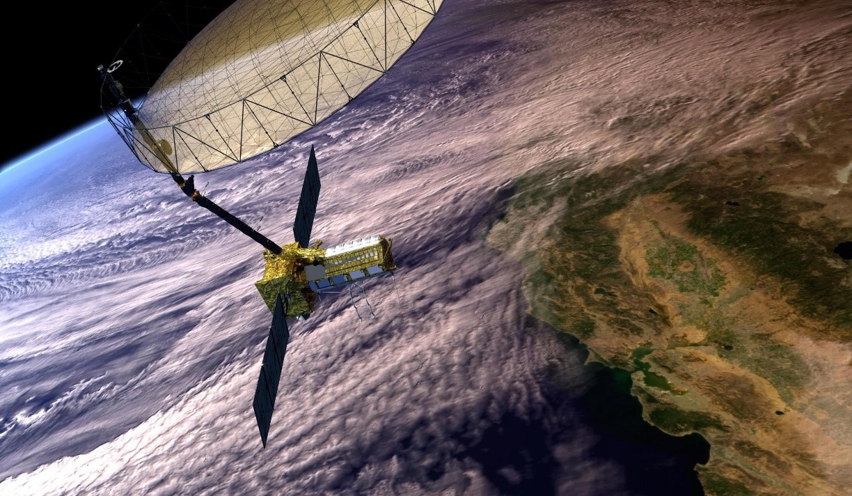
Figure 1. NISAR: New Satellite to Track Earth's Hidden Shifts
Tracking Earth’s Shifts
Earth’s surface is constantly shifting, often unnoticed by us. For years, scientists have used satellites and ground-based tools to monitor movements related to earthquakes, volcanoes, landslides, and other geological phenomena. Now, a new satellite developed by NASA and the Indian Space Research Organisation (ISRO) promises to enhance our understanding of these shifts and could help improve our ability to prepare for and recover from both natural and human-made disasters. Figure 1 shows NISAR: New Satellite to Track Earth's Hidden Shifts.
The NISAR (NASA-ISRO Synthetic Aperture Radar) mission will observe nearly all of the Earth’s land and ice-covered surfaces twice every 12 days. [1] This frequent data collection will give researchers a more comprehensive view of how the planet’s surface evolves over time. “This kind of regular observation lets us monitor Earth’s surface movements across nearly the entire globe,” says Cathleen Jones, NISAR applications lead at NASA’s Jet Propulsion Laboratory (JPL) in Southern California.
In combination with data from other satellites and instruments, NISAR’s observations will offer a more comprehensive view of Earth’s surface movements, both horizontal and vertical. This information will be vital for understanding the mechanics of Earth’s crust and identifying regions at higher risk for earthquakes and volcanic eruptions. It could also help determine if parts of a levee are damaged or if a hillside is beginning to shift, signaling a potential landslide.
Cutting-Edge Radar Technology
Scheduled for an early 2025 launch from India, the mission will be capable of detecting surface movements as small as fractions of an inch. In addition to monitoring changes to Earth's surface, the satellite will track the movement of ice sheets, glaciers, and sea ice, as well as map vegetation changes.
The source of this exceptional detail lies in a pair of radar instruments operating at long wavelengths: an L-band system developed by JPL and an S-band system built by ISRO. NISAR is the first satellite to carry both instruments. Each can gather data day or night and can see through clouds that typically obstruct optical instruments. The L-band instrument is also capable of penetrating dense vegetation to measure ground motion, which will be particularly valuable in regions with volcanoes or fault lines hidden by thick plant cover.
Improved Earthquake and Volcano Prediction
"The NISAR satellite won't predict the exact timing of earthquakes, but it will help us better understand which regions are most vulnerable to major seismic events," explained Mark Simons, U.S. solid Earth science lead for the mission at Caltech.
Data from the satellite will provide insights into which sections of a fault experience slow, gradual movement without triggering earthquakes, and which parts are locked and could suddenly slip. In well-monitored regions like California, NISAR will allow researchers to pinpoint specific areas that might be at risk. For less monitored parts of the world, NISAR could uncover new earthquake-prone zones. Additionally, when earthquakes occur, the satellite will help scientists analyze fault movements and the causes of the ruptures.
"From the ISRO’s perspective, we are especially interested in the Himalayan plate boundary," said Sreejith K M, ISRO’s solid Earth science lead for NISAR at the Space Applications Center. "This area has experienced powerful earthquakes in the past, and NISAR will provide unprecedented information on the seismic risks in the Himalayas."
The satellite’s surface motion data will also be invaluable to volcano researchers, as it will enable the regular monitoring of land movements that could signal potential eruptions. As magma shifts beneath the surface, the land can rise or sink. NISAR will help researchers better understand these deformations and whether they indicate an impending eruption.
Ongoing Monitoring for Infrastructure Stability and Safety
NISAR’s ability to provide continuous, long-term measurements will revolutionize infrastructure monitoring, helping to establish baseline conditions for structures like levees, dams, and aqueducts. This allows for targeted inspections when changes occur, improving efficiency. Instead of conducting widespread surveys, managers can focus on specific areas showing signs of trouble. For example, after a significant event like an earthquake, NISAR can detect shifts in infrastructure, like liquefaction affecting dams and levees, reducing the need for exhaustive manual inspections and saving time and money on repairs.
Additional Insights on NISAR
NISAR (NASA-ISRO Synthetic Aperture Radar) is a pioneering Earth observation mission developed jointly by NASA and the Indian Space Research Organisation (ISRO). [2] This collaboration represents the first hardware project between the two agencies, combining NASA’s Jet Propulsion Laboratory (JPL) and ISRO’s U R Rao Satellite Centre. The satellite is designed to monitor Earth’s surface changes with remarkable precision. JPL is responsible for the U.S. component, which includes the L-band radar, radar reflector antenna, deployable boom, high-rate communication system, GPS receivers, solid-state recorder, and the payload data subsystem. ISRO contributes the spacecraft bus, launch vehicle, mission operations, and S-band radar electronics. Together, the agencies aim to utilize NISAR’s advanced capabilities to track land and ice movements across the globe, providing vital insights into natural and human-driven changes on Earth.
Reference:
- https://scitechdaily.com/nisar-the-powerful-new-satellite-that-will-track-earths-secret-shifts/
- https://www.downtoearth.org.in/science-technology/new-nasa-isro-satellite-nisar-to-revolutionise-earth-monitoring-disaster-preparedness
Cite this article:
Janani R (2024), NISAR: The Advanced Satellite Set to Monitor Earth's Hidden Movements, AnaTechMaz, pp. 128


