
Overview of Satellite Image Processing
Satellite Image Processing is an important field in research and development and consists of the images of earth and satellites taken by the means of artificial satellites. Firstly, the photographs are taken in digital form and later are processed by the computers to extract the information. Statistical methods are applied to the digital images and after processing the various discrete surfaces are identified by analyzing the pixel values.
The satellite imagery is widely used to plan the infrastructures or to monitor the environmental conditions or to detect the responses of upcoming disasters. [1]
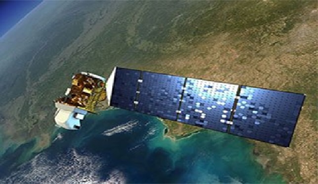
Figure 1. Overview of Satellite Image Processing
Figure 1 shows Satellite Imaging Corporation (SIC) provides high-resolution satellite imagery and image processing services for analysis and to support Geographic Information System (GIS) and other mapping applications.
SIC specializes in satellite imaging collections, producing seamless orthorectified imaging mosaics, DEMs (Digital Elevation Models), and 3D Digital Terrain Models (DTMs) for many industries using CAD and GIS applications utilizing high and medium resolution mono and stereo satellite image data. [2]
Applications of Satellite Imagery & Remote Sensing Data
Remote sensing data provides critical information that helps in monitoring various applications like image fusion, change detection and land cover classification. Remote sensing is a key technique used to obtain information related to the earth’s resources and environment. The availability of satellite images of high resolution satellite images along with features like “Street View” on various mapping applications like Google Earth and Bing Maps have really helped to popularize satellite imagery data.
Remotely sensed satellite images and data include spectral, spatial and temporal resolutions. Spectral resolution describes the ability of a sensor to define fine wavelength intervals and it involves elements of remotely sensed image classification. [3]
1. Providing a base map for graphical reference and assisting planners and engineers
The amount of details that an orthoimagery produces using high resolution satellite imagery is of immense value as it provides a detail image of the selected area along with its surrounding areas.
As maps are location-based they are specifically designed to communicate highly structured data and to give a complete picture about the whole world. There are numerous applications of satellite imagery and remote sensing data.
2. Disaster mitigation planning and recovery
The result of a natural calamity can be devastating and at times difficult to assess. But disaster risk assessment is necessary for rescue workers. This information has to be prepared and executed quickly and with accuracy. Object-based image classification using change detection (pre- and post-event) is a quick way to acquire damage assessments data. [4]
References:
- https://www.geeksforgeeks.org/satellite-image-processing/
- https://www.satimagingcorp.com/services/
- https://www.aabsys.com/satellite-image-processing-applications-possibilities/
- https://www.ceinsys.com/blog/applications-of-satellite-imagery-remote-sensing-data/
Cite this article:
Thanusri swetha J (2021), Overview of Satellite Image Processing, AnaTechMaz, pp. 76
Recent Post
-
Overview of Satellite Image Processing
Satellite Image Processing is an important field in research and development and consists of ....
-
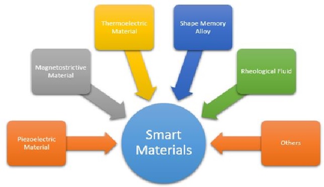
Types of Smart Material Technology
Smart materials are materials that are manipulated to respond in a controllable and reversible ....
-
Stackable “Holobricks” Can Make Giant, Highly Realistic 3D Holographic Images
The researchers, from the University of Cambridge and Disney ....
-
3D Password
The 3D password presents a 3D virtual environment containing various virtual objects. The user navigates through this environment and interacts...
-

Ajax
AJAX is the most viable Rich Internet Application (RIA) technology so far. It is getting tremendous industry momentum and several tool kit...
-

Apple Announces Powerful 'Mac Studio' With M1 Ultra Chip and Companion 'Studio Display'
Apple Announced March 8, 2022 9:41 am at its "Peek Performance" event announced...
-

Benefits and drawbacks of online learning (wired classroom)
A wired classroom is exactly what it sounds like, a classroom connected...
-

Best practices to leverage digital trust
Digital Trust is a concept that enables users to carry out business transactions in a safe, secure, ethical and ...
-

The Digital Forensic Investigations
Digital forensics comprises of the techniques which deal with the investigation and searching of digital evidence. It is a branch...
-
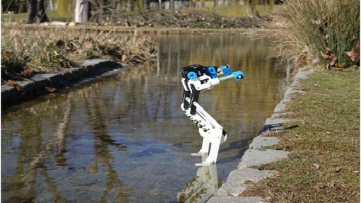
BirdBot is energy-efficient thanks to nature as a model
If a Tyrannosaurus Rex living 66 million years ago featured a similar leg structure as an ostrich running ....
-

CFD (Contract For Difference)
A contract for difference (CFD) is a contract between a buyer and a seller that stipulates that the buyer must pay the seller...
-

Rise of Chatbots(HTRC)
While most tech advancements help us move towards the greater good, some aren’t as beneficial as we might think....
-
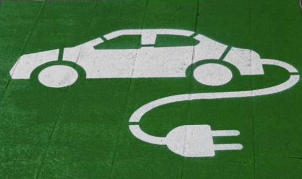
Boffins invent EV ‘power shell’
Boffins invent EV ‘power shell’ for increased range and performance. It's a power suit, but for EVs ...
-
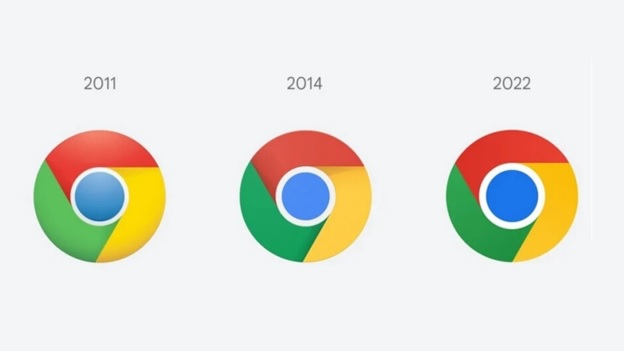
Google Releases chrome 100 for ios and desktop with updated Icon
Google Tuesday March 29, 2022 1:37 pm released version number 100 for the Chrome ...
-
Researchers show how to make ‘computer’ out of liquid crystals
Breakthrough at UChicago could pave the way for applications in robotics, computing...