

New Online Tool Reveals 320-Million-Year History of Any Home
What if you could rewind Earth’s history beneath your feet? A new online platform from Utrecht University makes that possible, allowing users to trace the ancient latitude of any modern location—stretching back an astonishing 320 million years to the height of the supercontinent Pangaea.
The tool, known as Paleolatitude.org, acts like a geological time machine. With just a few clicks, users can uncover how a specific location has drifted across the globe through deep time. Depending on the era, the ground you stand on today may once have been a tropical seabed, a barren volcanic landscape, or even part of a frozen glacial shelf.
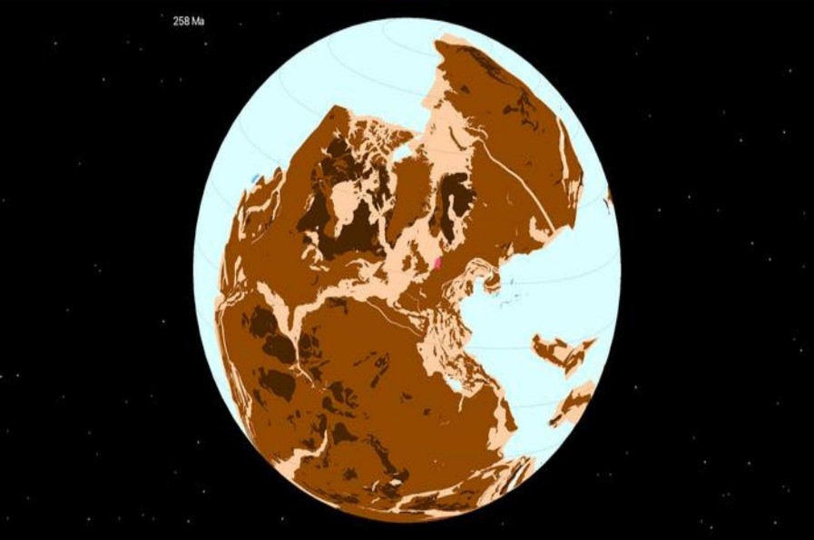
Figure 1. Location of The Netherlands (pink) in Pangaea, 258 million years ago.
Solving Earth’s Geographic Mysteries
The project originated from a puzzling discovery. Fossils found in Winterswijk in the Netherlands resembled species typically associated with the modern-day Persian Gulf. This raised an intriguing question—was the entire planet once uniformly hot? Figure 1 shows location of the netherlands (pink) in pangaea, 258 million years ago.
The answer lies in latitude. Since the angle of sunlight determines climate, a region’s position on the globe plays a crucial role in shaping its environment. Using Paleolatitude.org, researchers revealed that around 245 million years ago, the Netherlands sat at tropical latitudes similar to today’s Persian Gulf, explaining its ancient desert conditions without invoking extreme global heat.
According to geoscientist Douwe van Hinsbergen, the tool provides a groundbreaking global model that links rock formations to their original tectonic plates—many of which have since disappeared deep into Earth’s mantle.
Reconstructing Lost Worlds
To rebuild Earth’s ancient geography, scientists rely on a two-step process. First, they “unfold” mountain ranges to reconstruct how tectonic plates once fit together. This method has helped identify long-lost landmasses such as Greater Adria, Argoland, and the Tethys Himalayas—continents that have since been consumed by the planet’s interior but left traces in regions like the Mediterranean and Indonesia.
Next, researchers determine the original latitude of these plates by studying magnetic minerals locked inside ancient rocks. Because Earth’s magnetic field varies between the equator and the poles, these minerals act like a prehistoric GPS, revealing where rocks formed and how they traveled over millions of years.
A New Lens on Biodiversity
Beyond geology, Paleolatitude.org offers powerful insights into the history of life on Earth. By pinpointing where fossil-bearing rocks were originally located, scientists can track how ecosystems shifted across climates and how species responded to mass extinctions and dramatic temperature changes.
This three-dimensional view of Earth’s past highlights which regions acted as safe havens for life and which became uninhabitable. Such insights could prove valuable in understanding how modern ecosystems might respond to today’s environmental challenges.
Expanding the Timeline
Currently, the tool maps Earth’s history back 320 million years, but future updates aim to extend its reach to the Cambrian explosion around 550 million years ago. Ultimately, this evolving model could provide a comprehensive view of climate evolution and biodiversity resilience—while inviting anyone to explore the deep-time journey of their own location.
References:
- https://interestingengineering.com/science/new-online-tool-tracks-earths-tectonic-journey
Cite this article:
Keerthana S (2026), “New Online Tool Reveals 320-Million-Year History of Any Home”, AnaTechMaz, pp.1255